Hawk Rock
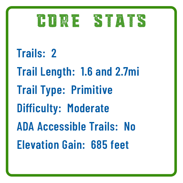
The hike to the Hawk Rock scenic overlook follows a section of the famed Appalachian Trail, the 2,190-mile route that travels through 14 states. This 2.7 mile heavily trafficked out and back trail has an elevation gain of nearly 700 feet. The AllTrails map shown here highlights a shorter, 1.6-mile option for accessing Hawk Rock. Same great panoramic views of the Susquehanna River from the top!
A clear gap between the trail side of the mountain and the ledge where it continues on the other side of the river is what makes this region a geological marvel. Geologists refer to this as a Water Gap, and this one is known as the Susquehanna Water Gap that cuts through the Blue Mountain Ridge.
The Hike
For the 2.7-mile version, follow the white blazes of the AT uphill on a rocky path for about 0.3 miles, where the AT path takes a short downhill to an old road. Continue walking on the AT about 1 mile uphill over sometimes steep and rocky terrain to the outcropping at Hawk Rock. This trail is wonderful for observing nature, bird watching, and taking Instagram-worthy snaps!
Featured Story
Tory Talks Trails: Hiking Hawk Rock
Rocks and Heights
This hike is rated as “Moderate” for its steeper inclines and sections of loose rock. The trail sees plenty of families with children, but we recommend that any children hiking to Hawk Rock have some hiking experience most preferably with rocky terrain and elevations.
Getting There:
Follow US Route 22/322 W across the Susquehanna River and take the first turn-off on the left immediately after crossing the river for PA Route 849. Follow Route 849 across the Juniata River and under the railroad bridge and bear left immediately after going under the railroad bridge onto Market Street in the town of Duncannon. Follow Market St. through town and under the US 11/15 highway overpass. Just after the overpass make a left onto Main Street. Continue straight on Main Street crossing Sherman Creek to the parking lot, which is located about 0.5 miles from the US 11/15 overpass (Geocoordinates: 40.381466,-77.029290).
Cookies are used for optimization and tracking. By continuing to use our site you agree to our privacy policy.
Cookies are used for optimization and tracking. By continuing to use our site you agree to our privacy policy.


